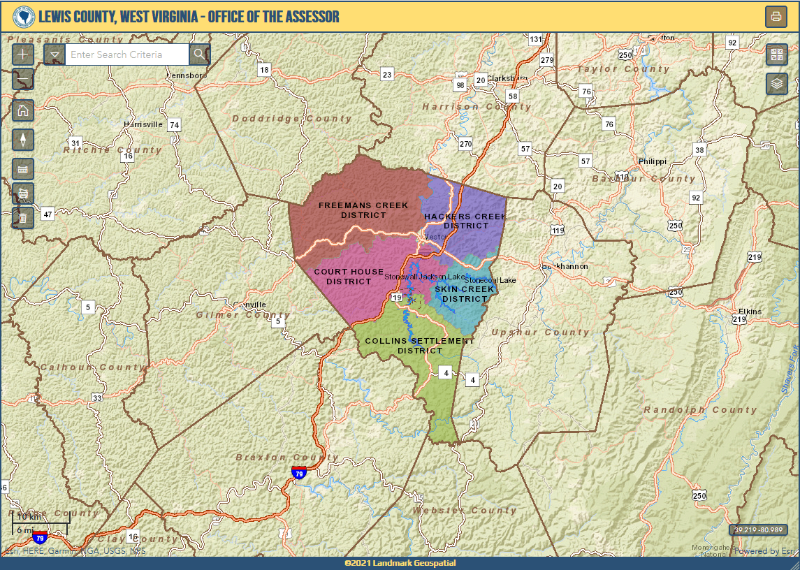
Lewis County Assessor Tool
With the deprecation of Adobe Flash, the Lewis County, WV parcel web mapping tool originally built with the Flex API would soon lack support. I re-developed the tool as a responsive mapping application using the Esri ArcGIS API for JavaScript, SQL Server, and Bootstrap.
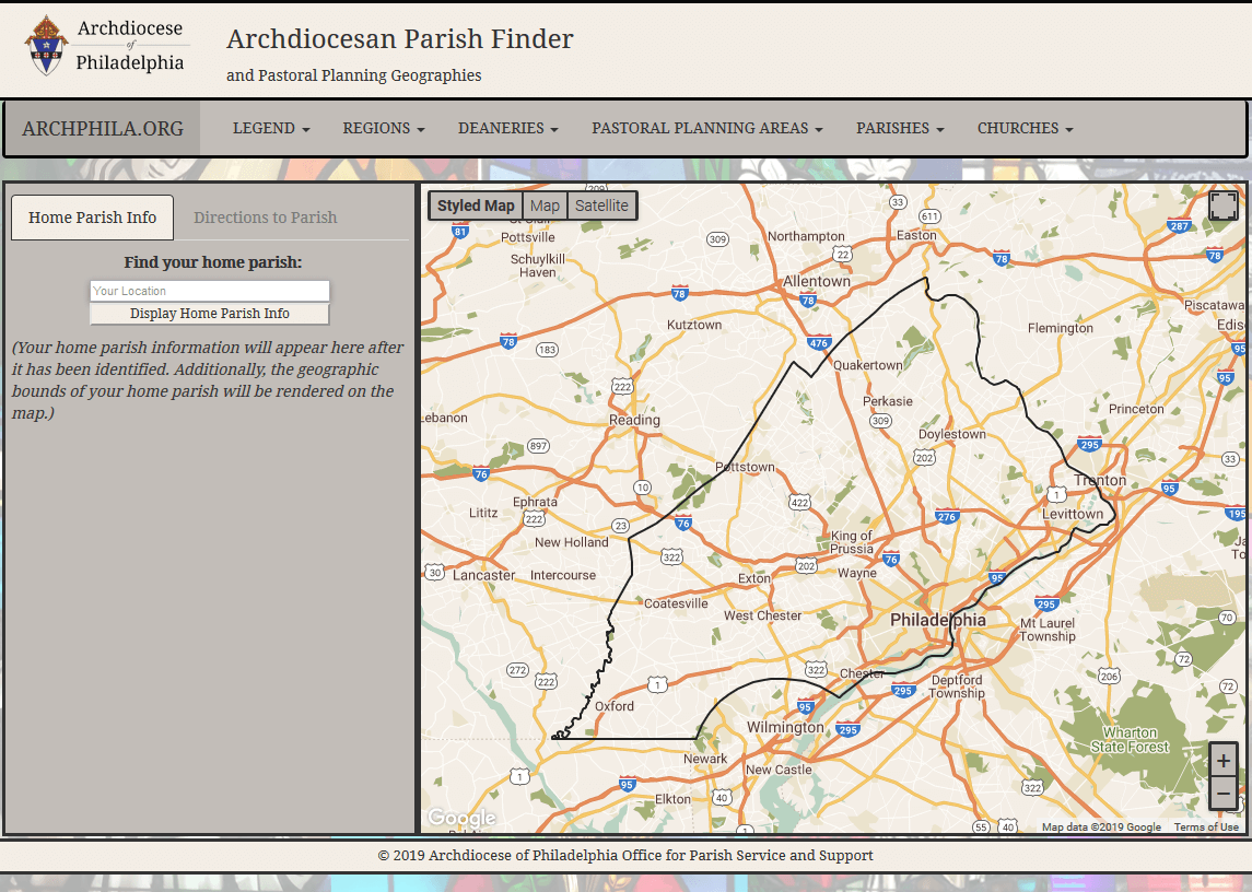
Parish Finder
My Final Practicum project for my M.S., 'Parish Finder' utilizes the Google Maps API, HTML5, CSS, Bootstrap, JavaScript, PHP, and the MySQL RDBMS. The tool supports the Archdiocese of Philadelphia's Office for Parish Service and Support.
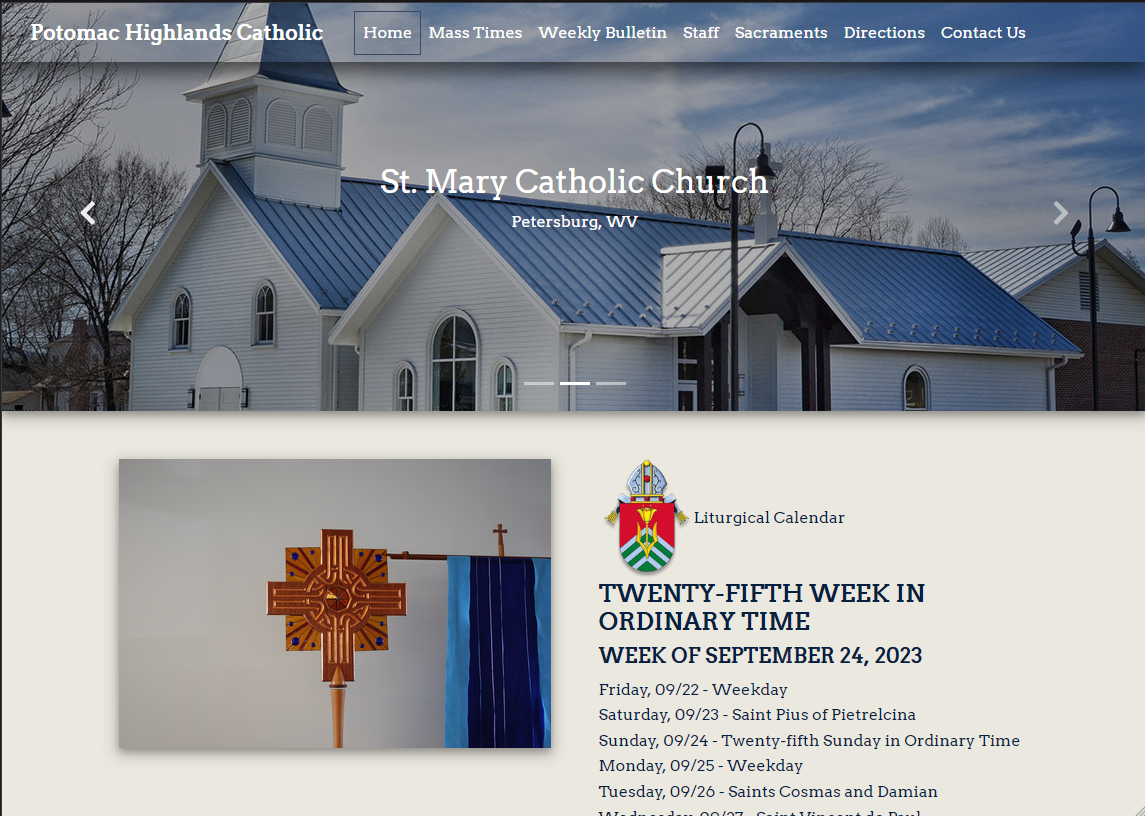
Potomac Highlands Catholic
Mobile-responsive website for parishes in the Potomac Highlands region of West Virginia - St. Elizabeth Ann Seton, St. Mary's, and Epiphany of the Lord. Built (and still maintain) this site as a 'thank you' to the parish that served me well while I was stationed in Sugar Grove, WV.
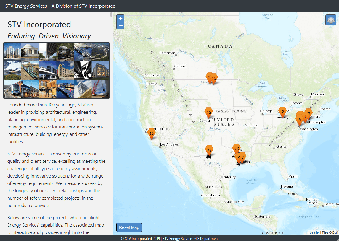
STV Projects Story Map
Proposed as a marketing resource, this web mapping application is a "story map" - the story panel and map features are synchronized. Built using Leaflet, JavaScript, jQuery, and Bootstrap, the application highlights a few different Energy Services projects.
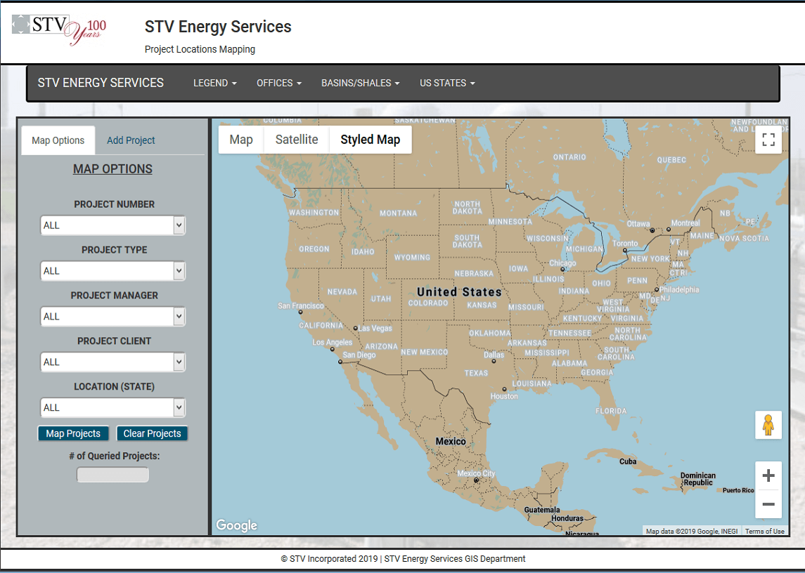
STV Energy Services Tool
Developed as one element of my GEOG 777 M.S. capstone course, this application uses the Google Maps API and MySQL to query STV projects based on multiple filters. Additional tools allow designated users to enter live data into the backend database.
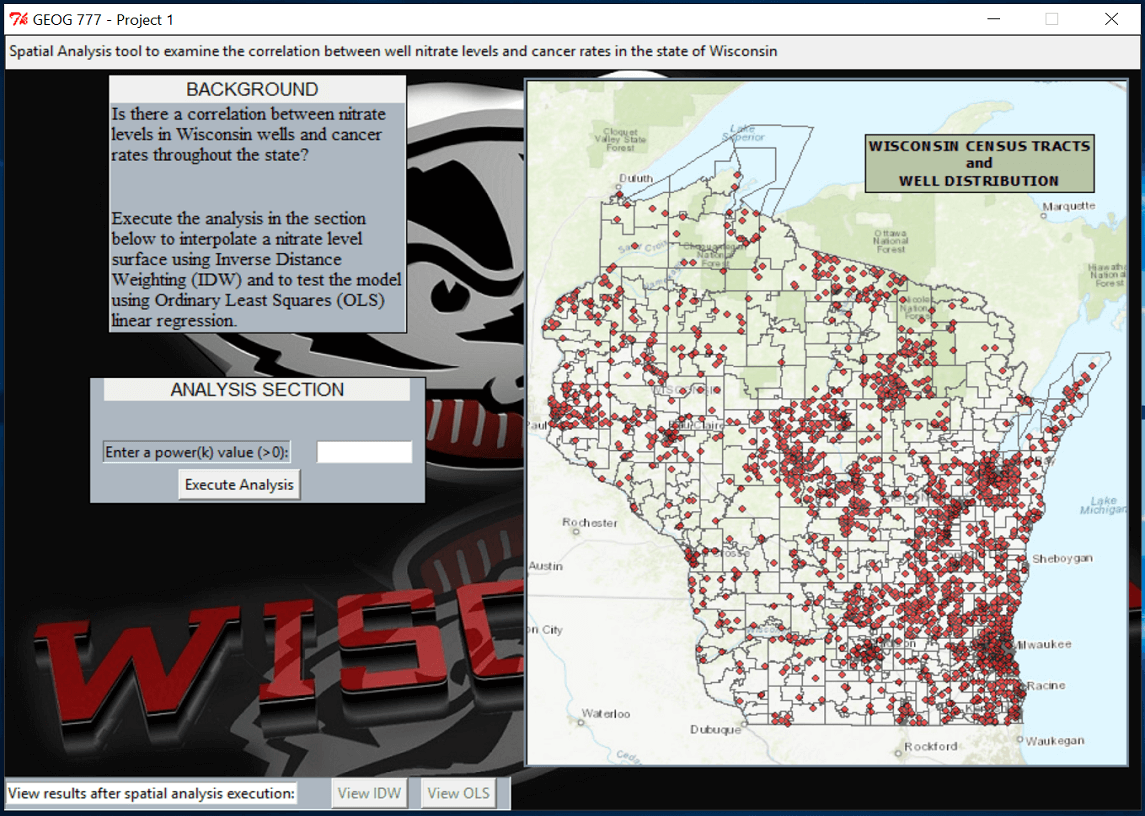
Spatial Analysis with Python
Also developed in my GEOG 777 M.S. capstone course, this application leverages Python, Esri's ArcPy site package, and the Tkinter GUI toolkit. Interpolation of well data and linear regression examine the potential correlation between the dependent and independent variables.
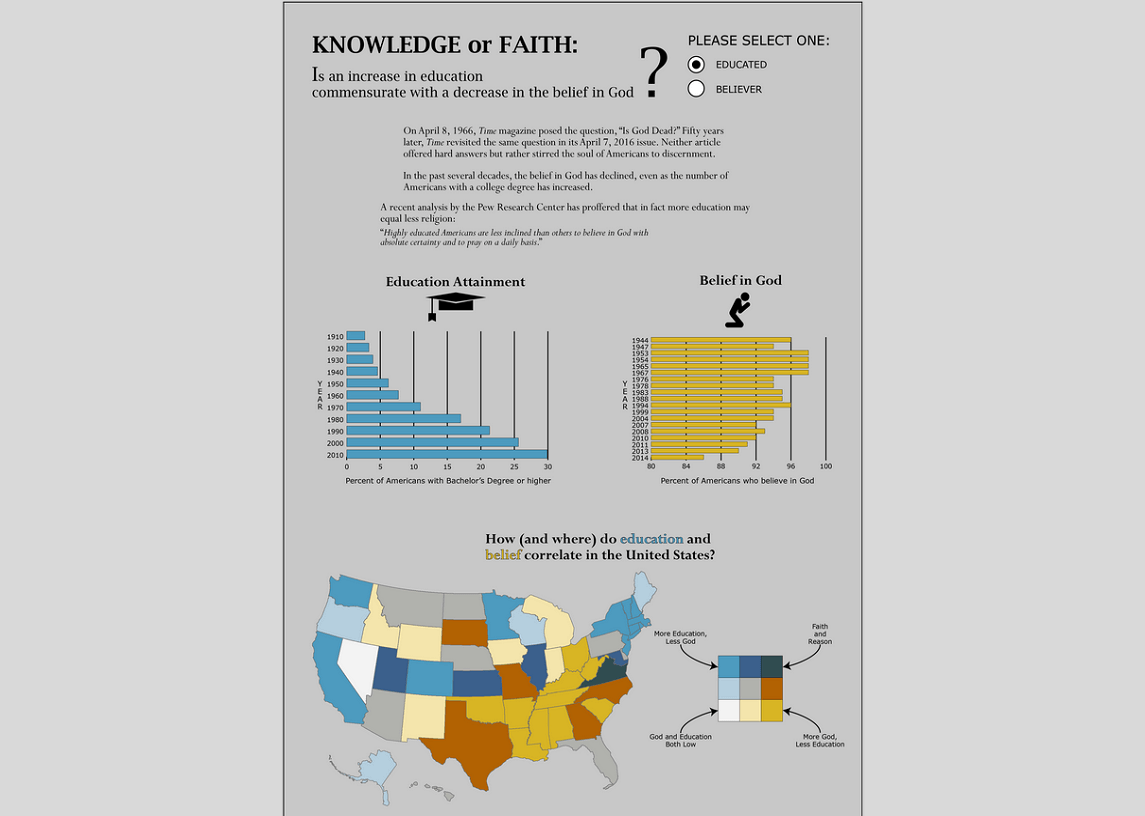
Faith and Reason Infographic
Infographic exploring the relationship between education and belief in God. Data compiled from the U.S. Census Bureau, the Pew Research Center, Gallup, and the NCES. Cartography performed in ArcGIS and final product polished in Adobe Illustrator.
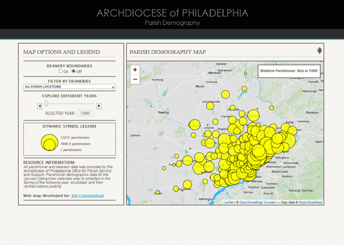
Parish Demography
The Catholic Church in the United States is ever-evolving. But what does that evolution look like? This Parish Demography application (built with Leaflet) explores the changing parish demographics throughout the Archdiocese of Philadelphia from 1980-2015.
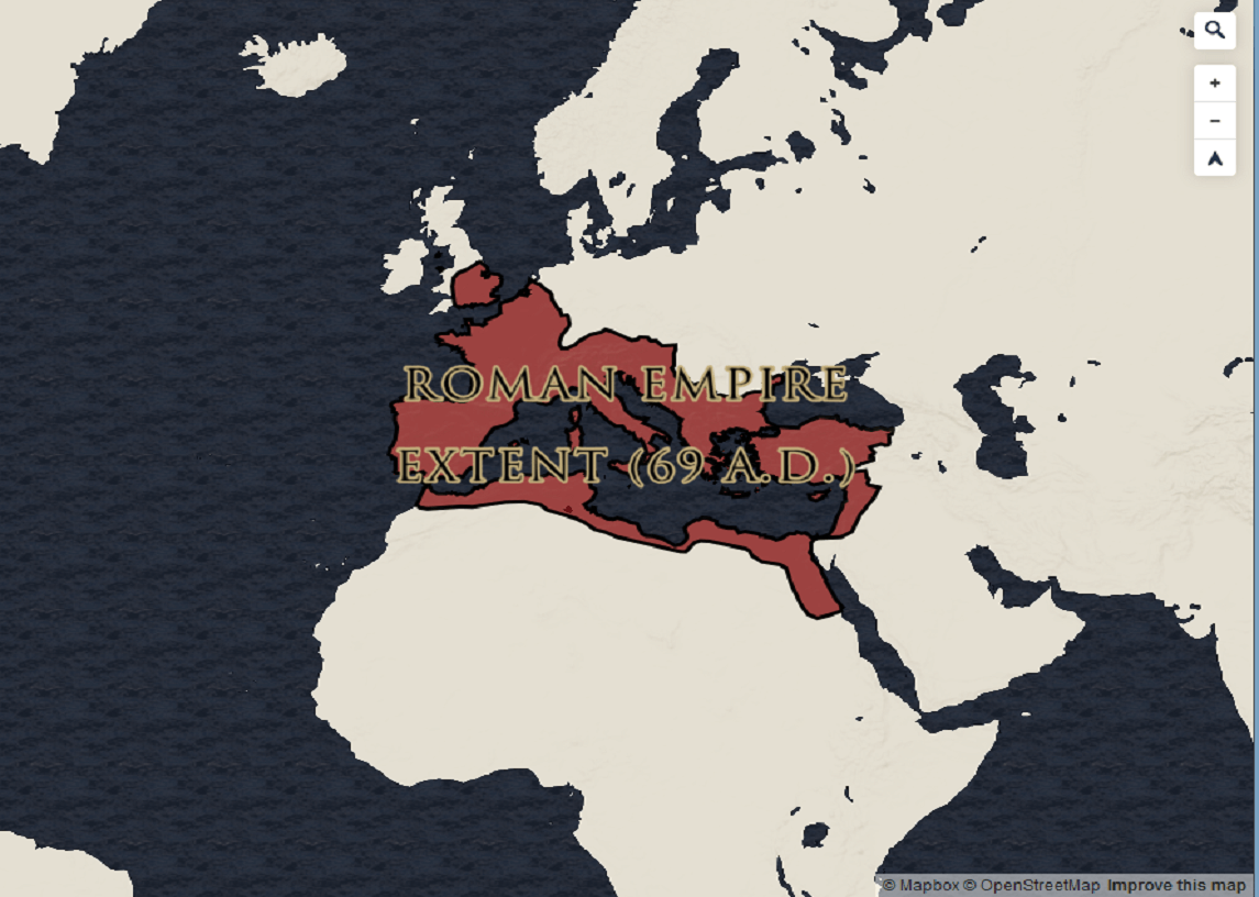
Saint Paul's Journeys Tileset
'St. Paul's Rome and his Journeys' is based on Paul of Tarsus, a Christian apostle whose ministry was situated in the middle of the first century A.D. His mission began in Judea and was carried out in various parts of the Roman Empire. Built using Mapbox Studio.
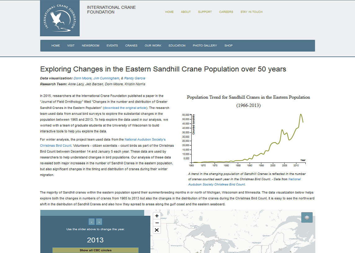
Eastern Sandhill Cranes
During an M.S. course project, I worked with two other students - Randy Garcia and Dorn Moore - to develop an application to serve the informational and exploratory needs of the International Crane Foundation. Developed using Leaflet, D3, and Bootstrap.
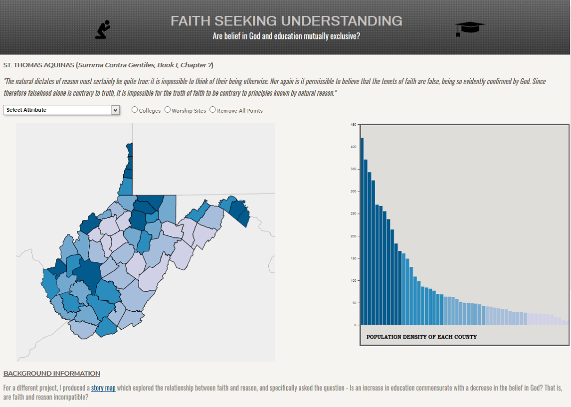
D3 Geovisualization
Using the D3.js JavaScript library, this application explores the correlation among various demographic attributes and religious worship practices in the state of West Virginia. Data sources: U.S. Census Bureau and the Association of Religious Data Archives (ARDA).
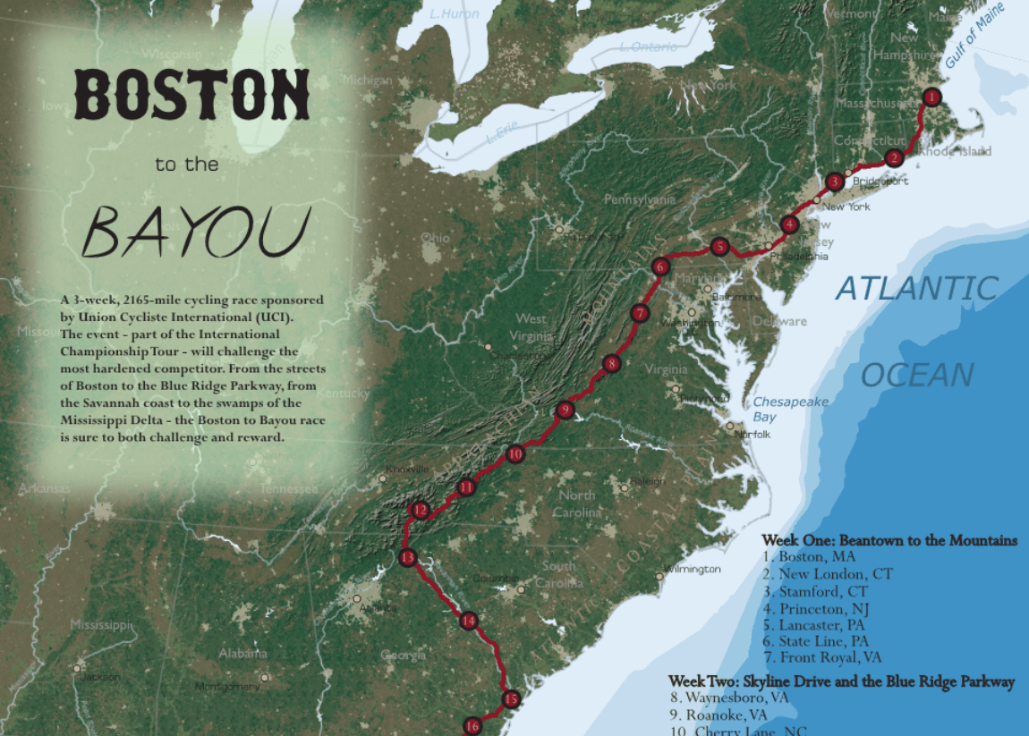
Boston the the Bayou Bike Tour
A hypothetical bike route through Skyline Drive and the Blue Ridge Parkway in the Shenandoah Valley. This effort involved DEM and land cover geoprocessing in ArcGIS, raster processing with Adobe Photoshop, and vector/raster manipulation in Adobe Illustrator.

stvenserv.com
In support of project web mapping applications for STV Energy Services, I developed this Energy Services website to serve as an informatory tool for both clients and in-house personnel. Various other project-specific applications are built upon this root website.